

Urbanismo PRO Layers: Analyze Land Before You Bid
Land classification, flood zones, Natura 2000, coastlines and livestock routes on the auction map. Spot restrictions before you bid.
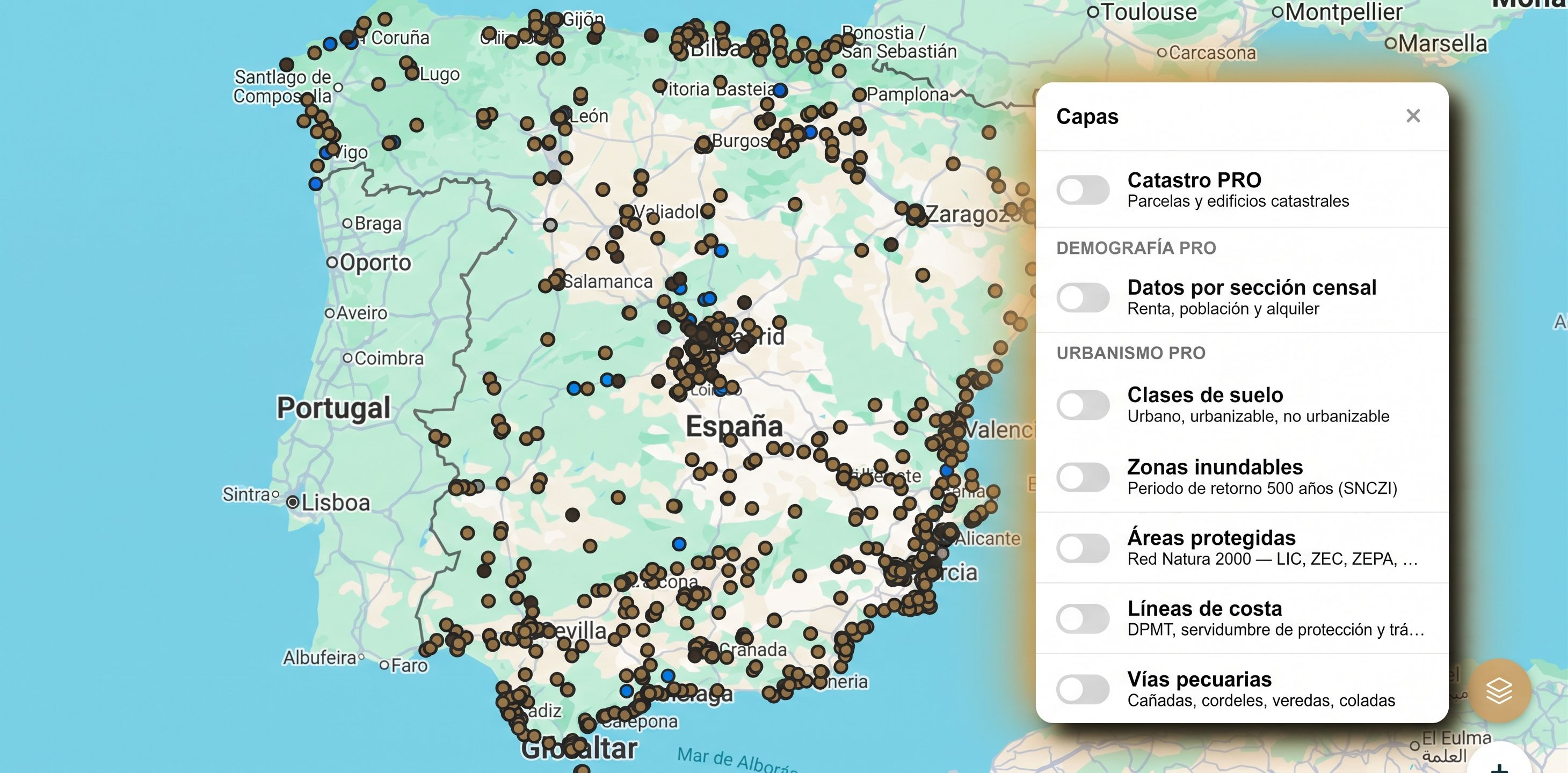
“Knowledge is power.” — Francis Bacon
An auction listing gives you the address, the appraisal value and the encumbrances (in Spanish). What it doesn’t tell you, at a glance, is what surrounds that property: whether the land can be built on, whether floodwater can reach it, whether a protection status applies, or whether a public route crosses the plot.
That information exists, but it is scattered across the viewers of different administrations. Gathering it by hand for every asset takes hours. With MapaSubastas’ Urbanismo PRO layers, you have it overlaid on the map, on top of each auction, at a glance.
Why cross-checking data before bidding matters
A property can have an attractive appraisal value and a reasonable starting price, and still hide a restriction that changes the whole operation. It doesn’t always appear in the BOE listing, and it isn’t always caught with a quick search.
The layers don’t replace the Nota Simple (the official land registry extract) or an urban planning certificate, but they do tell you where to look and what to rule out before investing time and money. That is the difference between reviewing 40 listings blindly and reviewing 8 with sound criteria.
The six Urbanismo PRO layers
Each layer is activated independently from the “Capas” (Layers) panel and is displayed in its own color on the map. You can combine them to see the full picture.
1. Land classification: urban, developable and non-developable
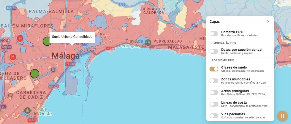
This is the layer that most conditions what you can do with the property. It distinguishes between urban land, developable land and non-developable land, each with its own color range.
Non-developable land significantly limits construction and permitted uses. If you plan to renovate, build or subdivide, it’s better to know before the bid and not after the award.
2. Flood zones (500-year return period)
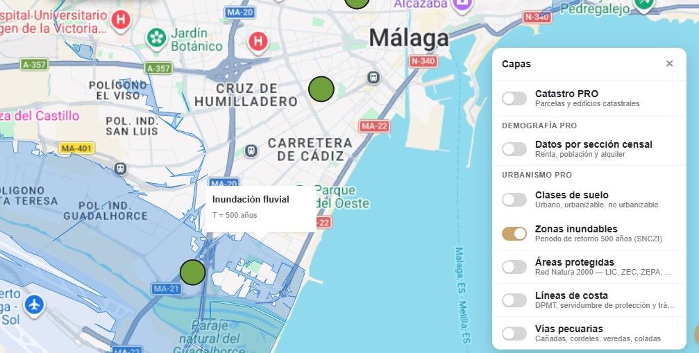
It shows the areas at risk of flooding according to the National Flood Zone Mapping System (SNCZI), with a 500-year return period.
A 500-year return period doesn’t mean it happens once every 500 years, but that the annual risk is 0.2%. It is a useful reference for assessing use restrictions, insurance conditions and the real risk of the asset.
3. Protected areas (Natura 2000 Network)
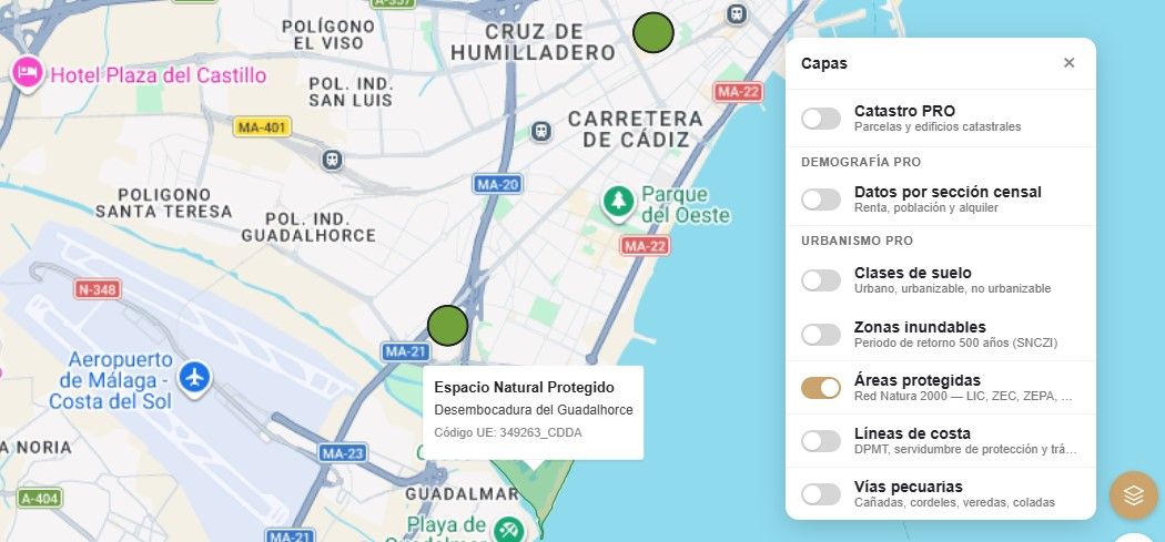
It includes the sites of the Natura 2000 Network: LIC, ZEC and ZEPA (the Spanish designations for Sites of Community Importance, Special Areas of Conservation and Special Protection Areas), among other figures. When you click on an area, the map shows its name and its European code, like the “Bahía de Málaga-Cerro Gordo” ZEPA in the screenshot.
Being inside or next to a protected area can affect permits, works and land use. It is a piece of data that changes the margin of an operation and that is almost never mentioned in the listing.
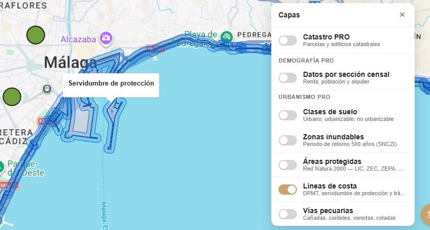
4. Coastlines (DPMT and easements)
It represents the maritime-terrestrial public domain (DPMT) and the protection and access easements regulated by Spain’s Coastal Law.
If the property is near the coast, this layer lets you check at a glance whether any of those zones affect it. The limitations on works and uses in these strips can be significant, and it is advisable to confirm them before calculating a renovation.
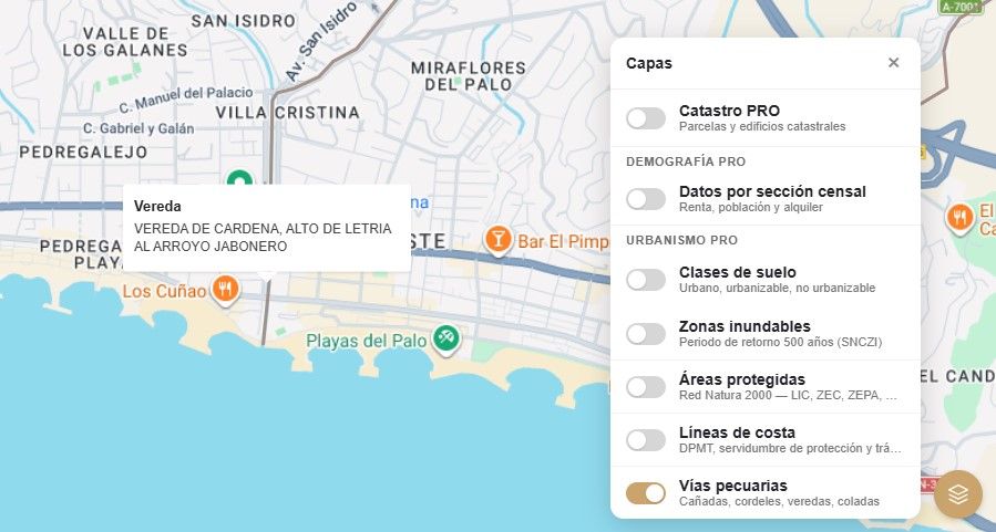
5. Livestock routes (vías pecuarias: cañadas, cordeles, veredas and coladas)
These are historic public-domain paths, originally designed for the movement of livestock. They still exist, they are protected, and they can cross or border a rural plot without the listing mentioning it.
When you click on the route, the map shows its type and name, like the vereda in the screenshot. It is one of those things that, if you don’t look for them, you won’t find.
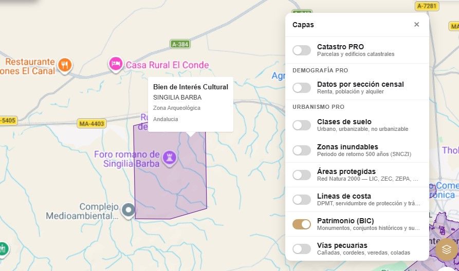
6. Heritage (BIC) New
This is the latest layer we’ve added to Urbanismo PRO, and it has just been released. It shows the Bienes de Interés Cultural (BIC, or Assets of Cultural Interest), the highest category of protection for Spanish historic heritage: monuments, historic ensembles, archaeological zones and other declared elements.
When you click on an element, the map shows its type of protection and its name. A property inside or next to a BIC usually faces limitations on works and interventions, which normally require authorization from the competent cultural administration. It is a factor that affects timelines, costs and the feasibility of a renovation, and it is worth knowing before bidding.
How to use them in your analysis
A reasonable workflow would be this:
- Locate the auction on the map and activate the land classification layer.
- Cross-check with flood zones and protected areas.
- Verify coastlines and livestock routes if the property is rural or near the coast.
- Review the heritage (BIC) layer if the property is in a historic center or near an archaeological site or monument.
- Confirm with the Nota Simple and, where applicable, with the urban planning certificate from the town hall.
- Calculate the real return with the calculator before deciding.
An important caveat: the layers guide, they don’t replace
The layers reflect official cartography and are indicative. The exact boundaries of a plot, exceptions and the particularities of each municipality must always be confirmed with the documentation and the competent authorities.
What they do give you is an advantage: you arrive at that verification knowing what to ask.
Frequently asked questions about planning rules at auction
How can I tell if the land in an auction is developable?
Land classification is set by each municipality's urban plan. The land classification layer gives you a first indication on the map; to confirm it, check the plan in force or request a planning certificate from the town hall.
Can you build on non-developable land?
In general, the options are very limited. Depending on regional and local rules, some buildings linked to agricultural use or public interest may be authorised, but not unrestricted residential construction. If your plan involves building, confirm it before bidding.
What does it mean if a property is in a flood zone?
It may face restrictions on use and construction, and it can affect insurance and resale value. The SNCZI layer flags the risk; the specific restrictions should be checked with the relevant river basin authority.
How does Spain's Coastal Law affect an auctioned property?
If the property lies within the maritime-terrestrial public domain or its protection easement, generally a strip of up to 100 metres from the shoreline, permitted works and uses are restricted. The coastlines layer lets you spot this before you budget a renovation.
Try it on a real auction
Open the map, pick a property you already have on your radar and activate the six layers one by one. You will likely discover something the listing didn’t say.
Information is the starting point. Judgment is what you do with it.